Living on the Miami River: A Neighborhood Guide to Miami’s Riverfront
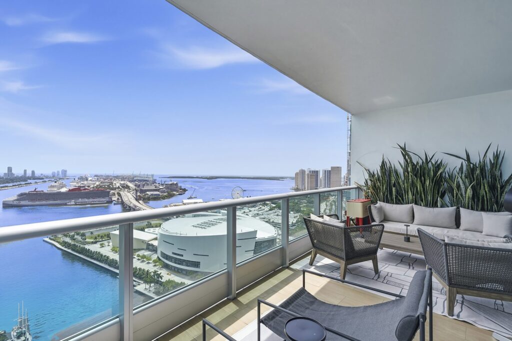
Photo courtesy to Miami Luxury Homes
A guide to living on the Miami River: where the river runs, the Riverwalk and parks along it, the history on its banks, life on a working waterway, and what to ask before you buy.
The Miami River is easy to cross without noticing. It runs under the Brickell Bridge at the edge of Biscayne Bay and winds inland between Downtown Miami and Brickell, past Little Havana and Overtown, toward Allapattah and the airport. For much of the city’s history it was a working river, and in many places it still is. It is also where the City of Miami has spent decades assembling a public Riverwalk, and where new residential towers are adding to the riverfront skyline. This guide covers what living on the river is like: where it runs, the walkways and parks along its banks, the history the city has preserved there, boating and bridges, and transit. Facts come from City of Miami pages, the Miami Downtown Development Authority (Miami DDA) and the Miami River Commission’s 2026 river map, all read on October 12, 2026.
Where the river runs
The Miami River Commission’s 2026 map traces the river from its mouth at Biscayne Bay, where the Brickell Bridge is the first crossing, to the Miami International Airport area and a salinity dam upstream. Neighborhood labels along its banks include Downtown, Overtown, Little Havana, Allapattah and Flagami. Near the mouth, the north bank is Downtown Miami and the south bank is Brickell, so a riverfront residence there sits within reach of both.
The City of Miami describes the Miami River Greenway as an urban greenway project that will eventually form an uninterrupted walkway from the mouth of the river in Downtown Miami to the Dolphin Expressway near the Civic Center area. That is the long-range plan. Today the walkway exists in sections, and the map marks which stretches are existing Riverwalk, proposed Riverwalk, existing on-road Greenway and proposed on-road Greenway.
Three features shape daily life on the river more than anything else: the public Riverwalk along the water’s edge, the bridges that open for boats, and the mix of residential towers with marinas, boatyards and shipping terminals upriver.
A river older than the city
The river is where Miami began. The Miami River Commission’s map notes that the river was central to the birth of the City of Miami, that it was the city’s main source of drinking water until 1910, and that “Miami” is a Tequesta term for “sweet water,” which came from the river. Several sites along the banks are part of the city’s preserved history:
- Miami Circle. A 2,000-year-old stone circle was found on the south bank of the river’s mouth during an archaeological survey ahead of planned construction, per the Commission. The State of Florida, the Florida Inland Navigation District, the South Florida Water Management District, the City of Miami and the Downtown Development Authority replaced the site’s seawall and finished a publicly accessible riverwalk there in 2011.
- Fort Dallas. Built in 1844 from oolitic limestone on a plantation on the north bank of the river’s mouth, it later served as an Army post, trading post, courthouse, post office and tea room. When it faced demolition in 1925, it was taken apart and rebuilt in Lummus Park by agreement with the City of Miami.
- Wagner Homestead. A pre-1858 pioneer house built by William Wagner, relocated and restored by the Dade Heritage Trust and designated a historic site by the City Commission in 1984.
- Flagler Workers House. An 1897 “Royal Palm Cottage” from Henry Flagler’s hotel era, moved to Fort Dallas Park on the river and designated a historic site by the City Commission in 1983.
- Spring Garden. A 1919 riverside subdivision designated a historic neighborhood by the City Commission in 1997.
For a buyer, this history is part of the setting: protected sites, older parks and designated districts sit beside new towers, and they are not going anywhere.
The Riverwalk and the Greenway
The public walkway along the river exists because of a rule. According to the Miami DDA, a City of Miami ordinance passed in 1979, known as the Dan Paul ordinance, requires new buildings to be set back 50 feet from the water’s edge and to build and maintain a 25-foot public pedestrian promenade along Biscayne Bay or the Miami River. Each new waterfront project adds a piece, which is why the Riverwalk has grown section by section.
The Miami DDA’s planning page reports that the 10-mile Miami Riverwalk and on-road Greenway are 68 percent complete, and lists recent sections. A 500-foot section on the Downtown (north) bank near the river’s mouth opened on April 30, 2024, linking the bayfront walkway to the riverfront upstream. A 200-foot section at 40 SW North River Drive opened on July 24, 2024; the DDA notes ongoing issues with a seamless connection north to the West Flagler Street bridge.
Upriver, the City of Miami’s Resilience and Public Works pages list two Miami River Greenway projects on NW North River Drive, both with estimated schedules the City says may change:
| City project | Limits | Status (City page, May 2026) | Estimated construction |
|---|---|---|---|
| Miami River Greenway, Curtis Park East | NW North River Dr, NW 22 Ave to NW 24 Ave | Construction procurement | September 2026 to September 2027 |
| Miami River Greenway, NW N River Dr | NW 22 Ave to NW 19 Ave | Design | October 2027 to October 2028 |
The City’s scope for both includes sidewalks, ADA ramps, drainage and lighting built to the Miami River Greenway Master Plan. What this means for a resident: in many riverfront buildings, a public promenade runs between the tower and the water. Ask how the building separates its private pool decks and terraces from the walkway, and how the promenade is lit, maintained and secured.
Parks along the water
The City of Miami’s park directory lists several riverside parks with facilities residents can use:
- Jose Marti Park, 362 SW 4th Street. The City lists it as a waterfront park with a playground, baseball and basketball, outdoor gym equipment, picnic tables, bike racks and leashed dogs allowed, open 6 a.m. to 10 p.m. daily, with an aquatic facility nearby at 351 SW 4th Street. The Miami River Commission notes the site was a Native American camp around 400 A.D., housed Cuban refugees in 1980, and became Jose Marti Park in 1984, named after the Cuban independence hero and poet.
- Jose Marti Gym, 434 SW 3rd Street, listed by the City with a gymnasium, indoor fitness room, free fitness classes and a waterfront setting.
- Lummus Park, 404 NW 3rd Street, listed as a historical site with a recreation center, playground, picnic tables, BBQ and basketball, open 8 a.m. to 9 p.m. daily. It is where Fort Dallas was rebuilt.
- Gerry Curtis Park, upriver on NW North River Drive. A 2022 City presentation lists sports fields and courts, a track, a boat ramp, a swimming pool, a community center and a playground, and the Curtis Park East Greenway project runs alongside it.
For parks on the bay side, our Brickell and Downtown Miami hubs cover the neighborhoods on either bank.
Getting around
The Miami River Commission’s map marks the transit stops closest to the lower river: the Metromover’s Riverwalk and Fifth Street stations, and the Metrorail’s Brickell and Government Center stations. The Metromover and Metrorail each cross the river on a fixed bridge. Brickell Avenue crosses on the Brickell Bridge at the mouth, and South Miami Avenue, SW 2nd Avenue, SW First Street and West Flagler Street each have their own bridge.
For daily life, that means a riverfront residence near the mouth can reach Brickell’s offices and shops and Downtown’s government and cultural buildings on foot or by Metromover. It also means bridge openings are part of the rhythm of the street, since a bascule bridge that is up for a vessel stops cars and pedestrians for a while.
On the water: a working river
The river is not only scenery. The Commission’s map lists marinas, boatyards, international shipping terminals and a public boat ramp along its length, alongside the restaurants and residential towers nearer the bay. Its bridge legend lists 16 crossings: 12 bascule (opening) bridges and four fixed crossings, which are the Metromover, Metrorail, Interstate 95 (three fixed spans) and State Road 836.
For a boat owner, that shapes the practical questions. Ask whether the building has dockage and on what terms, what vessel length and draft it allows, and whether your route passes under a fixed bridge that limits air draft. Opening rules for the bascule bridges are set by federal regulation, so check current rules with the U.S. Coast Guard rather than relying on a brochure. For a resident without a boat, the questions are different: how often nearby bridges open, how much commercial traffic passes, and whether a residence faces the water, the city or both. Our waterfront buyer guidecompares river, bay, Intracoastal and ocean frontage more broadly.
What to ask before buying on the river
Riverfront buying has its own checklist. Before you reserve, ask:
- Flood zone and elevation. The flood zone, the finished floor elevation of the lobby and garage, and where electrical and mechanical rooms sit. Our guide to hurricane readiness and building systems covers the questions in detail.
- Seawall. Who owns and maintains the seawall in front of the building, and how its upkeep is reflected in the association’s reserves. Our HOA fees guide explains how budgets and reserves work.
- The public promenade. Where the Riverwalk runs, who maintains it and how private areas are separated from it.
- Dockage. Whether slips are deeded, licensed, leased or not offered, and what they cost.
- Bridges and traffic. How often nearby bridges open and what commercial traffic passes the building.
- Construction nearby. What else is planned or under way on adjacent lots, and the City’s Greenway schedules near you.
- Rental rules and insurance. The association’s leasing rules and the building’s insurance program. See our guides to rental restrictions and Florida property insurance.
Our due diligence checklist covers the document review, and a Florida attorney should review the purchase agreement and condominium documents before you sign.
The river and its neighbors
The Miami River sits between two neighborhoods that many buyers already know. Brickell, on the south bank, is Miami’s financial district, and Downtown Miami, on the north bank, holds the Stephen P. Clark Government Center and the Miami-Dade Cultural Center, both marked on the Commission’s map. Our comparison of Brickell and Downtown Miami sets out the differences. Living on the river puts a resident between the two, with the water and the Riverwalk at the front door and a working waterway upstream. You can browse every tracked project on our new developmentspage.
FAQ: Living on the Miami River
Where is the Miami River?
The Miami River runs from Biscayne Bay, at the Brickell Bridge between Brickell and Downtown Miami, inland past Little Havana, Overtown and Allapattah toward the Miami International Airport area. The Miami River Commission’s 2026 map shows the river, its bridges, parks and historic sites, and the existing and proposed sections of the Riverwalk.
Is there a public walkway along the Miami River?
Yes, in sections. A 1979 City of Miami ordinance requires new waterfront buildings to provide a public promenade, and the Miami Downtown Development Authority reports the 10-mile Miami Riverwalk and on-road Greenway as 68 percent complete. The City of Miami has further Greenway segments scheduled for construction between 2026 and 2028.
Can you keep a boat on the Miami River?
The river is a working waterway with marinas, boatyards, shipping terminals and a public boat ramp. Many crossings, including those near the mouth, are bascule bridges that open for vessels, while four are fixed. Before buying, ask whether a building offers dockage, what vessel size it allows and what bridge clearances apply to your route.
What should I check before buying a riverfront condo in Miami?
Ask for the flood zone and finished floor elevations, who owns and maintains the seawall, how the public Riverwalk meets the building’s private areas, and whether dockage is deeded, licensed or not offered. Also ask about bridge-opening noise, nearby construction and rental rules, and have a Florida attorney review the condominium documents.